Assessment
Criteria
Discussion
No
Shipping Timber to Area with No Timber
All areas north of the narrow neck are forested. There is no area where timber was scarce.
Yes
No Cold or Snow
Average highs range from 79 to 93 degrees F (26 to 34 degrees C) and lows range from 59 to 75 degrees F (15 to 24 degrees C).
Yes
East Wind of Destruction
Hurricanes.
Yes
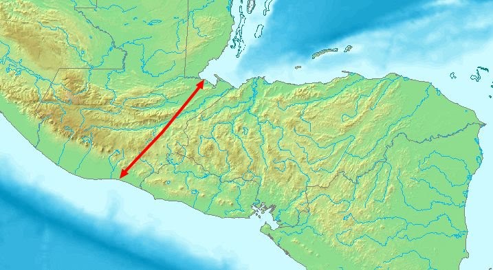
Narrow Neck
Yes
North-Flowing River
Rio Ulua, Rio Aguan, Rio Sico, Rio Paulaya, Patuca and Coco rivers.
No
Elevated Area West and South
All areas south of the narrow neck are mountainous. There are no distinguishable areas that can be described as a narrow south wilderness and there is no area of non-wilderness next to the area that would be the Hermounts. All of the listed rivers for Nicaragua and Honduras occur within river valleys, so they have no distinguishable elevated areas at their headwaters separate from the mountains that form the river valleys.
Maybe
Elevated Area East
No
Large Bodies of Water
The Peten is the only sizeable body of water north of the Isthmus of Darien and has a surface area of 125 km2. However, Lago de Izabal is located in the Isthmus of Darien and has a surface area of 590 km2. This does not fit the description that the waters of Ripliancum exceeded all others.
Some
Significant Natural Forces
For Nicaragua and Honduras, earthquake hazard maps indicate peak ground acceleration to range from 1.6 to >4.8 m/s2 (large). There are several volcanoes in the area. Storm surges and tsunamis occur on the east coast.
Narrow Neck Location 


