Assessment
Criteria
Discussion
No
Shipping Timber to Area with No Timber
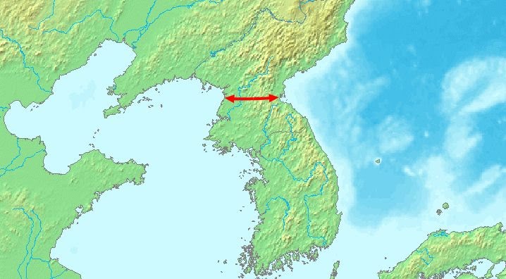
All areas north of the narrow neck are forested. There is no area where timber was scarce.
No
No Cold or Snow
Average highs range from 33 to 84 degrees F (1 to 29 degrees C) and lows range from 17 to 71 degrees F (-8 to 22 degrees C).
Yes
East Wind of Destruction
Typhoons.
Yes
Narrow Neck
No
North-Flowing River
No
Elevated Area West and South
Yes
Elevated Area East
No
Large Bodies of Water
Some
Significant Natural Forces
For North Korea, earthquake hazard maps indicate peak ground acceleration to range from 0.0 to 0.4 m/s2 (none to mild). Storm surges from typhoons and tsunamis occur on the east coast.
Narrow Neck Location 


