Assessment
Criteria
Discussion
Yes
Shipping Timber to Area with No Timber
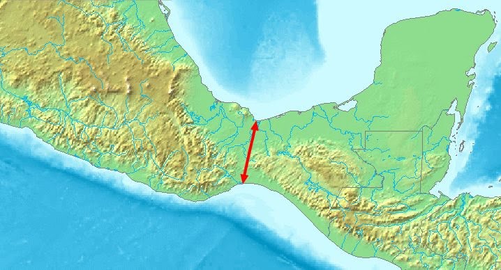
There is timber available in the Isthmus of Tehuantepec area. Mar Muerto is a lagoon on the Pacific (Sea West) side of the isthmus that has been used as a harbor since before modern explorers arrived. The Rio Balsas (also called Atoyac River) is a navigable river where it empties into the Pacific near the present day city of Lazaro Cardenas. Many rivers flow into the Rio Balsas (Helaman 2:4 [3:4]). The area of the Rio Balsas is arid and most trees grow within a few hundred feet of the river [see photo and article with photos]. The rest of the vegetation is widely spaced bushes. Timber can be easily over-harvested. The area between the isthmus and Rio Balsas is mountainous and not easily traveled over land, making shipping the easier mode of travel.
Yes
No Cold or Snow
Average highs range from 79 to 97 degrees F (26 to 36 degrees C) and lows range from 50 to 75 degrees F (10 to 24 degrees C).
Yes
East Wind of Destruction
Hurricanes.
Yes
Narrow Neck
Isthmus of Tehuantepec
Yes
North-Flowing River
Grijalva, Usumacinta, Hondo, and Belize rivers.
Yes
Elevated Area West and South
Yes
Elevated Area East
Maya Mountains.
Yes
Large Bodies of Water
Lago de Texcoco. Note: It was drained in 1607-1608. Historically, it had a surface area of up to 7,868 km2, though with no outflow, its size fluctuated. By comparison, Lago de Chapala is currently the largest lake in Mexico and had a surface area of 1,050 km2 in 1986 although human use has caused it to shrink since then.
Yes
Significant Natural Forces
For Mexico and Guatemala, earthquake hazard maps indicate peak ground acceleration to range from 1.6 to >4.8 m/s2 (large). There are several volcanoes in the area. Storm surges from hurricanes and also tsunamis occur on the east coast.
Narrow Neck Location 


