Verses 

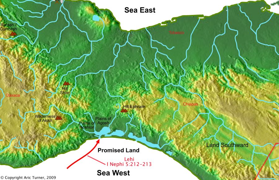
1 Nephi 5:212 And it came to pass that after we had sailed for the space of many days, we did arrive to the promised land;
World Location
Commentary
From Alma 13:74 [22:30]: And it bordered upon the land which they called Desolation; it being so far northward, that it came into the land which had been peopled, and been destroyed, of whose bones we have spoken, which was discovered by the people of Zarahemla; it being the place of their first landing. And they came from there up into the south wilderness.
The Jaredites never went south to the south wilderness. The Mulekites never went south to the south wilderness from Zarahemla. This leaves the meaning of this verse that Lehi’s landing was near the land Desolation (which is on the west sea shore at the narrow neck– which means Lehi left the old world on an eastern seashore). This agrees with Bountiful being on the Arabian peninsula as an eastern seashore.
The currents near Saudi Arabia flow north and east around India, and half the year flow past Malaysia and into the North Pacific Gyre. The other half of the year, the current flow changes around India and flows westward back to Africa. Winds for 9 months of the year are generally north and east and 3 months are generally west and south. Getting into the South Pacific Gyre from Saudia Arabia requires following a very specific route where currents and prevailing winds permit travel in that direction. Occams Razor would indicate that it was likely the course across the Great Waters was north of the equator. This also agrees with a landing at the Isthmus of Tehuantepec.