

Verses 

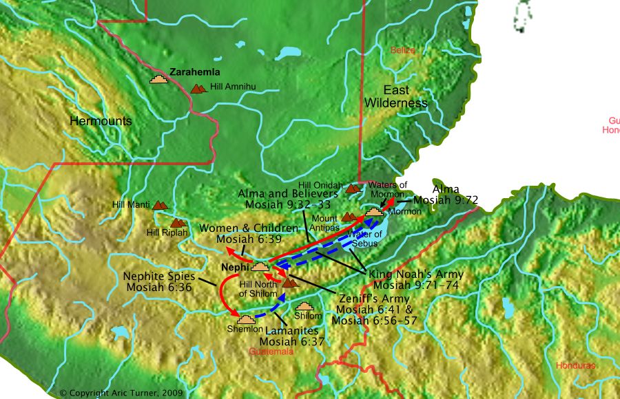
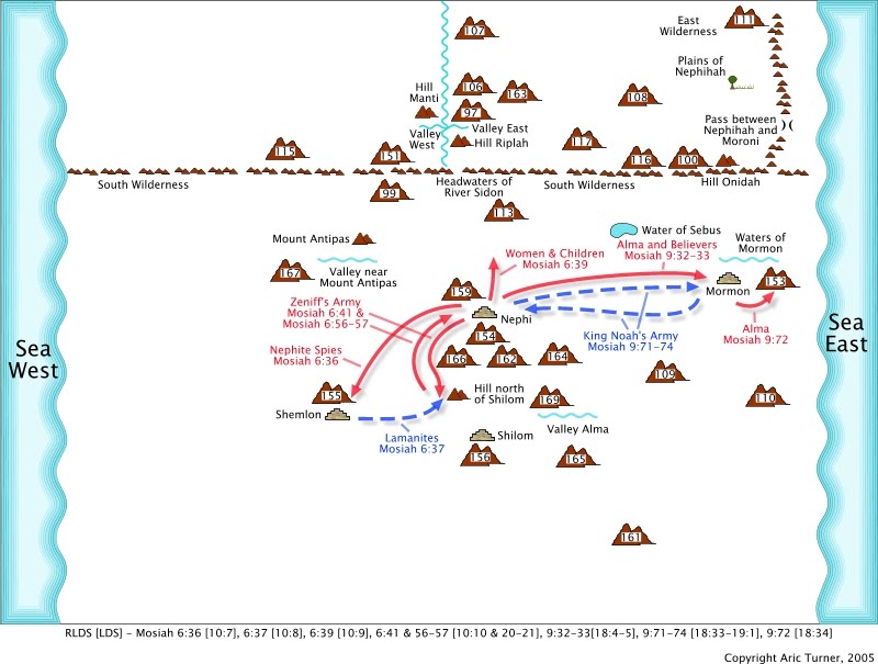
Mosiah 6:36 But I had sent my spies out round about the land of Shemlon, that I might discover their preparation, that I might guard against them, that they might not come upon my people and destroy them.
Mosiah 6:37 And it came to pass that they came up upon the north of the land of Shilom, with their numerous hosts, men armed with bows, and with arrows, and with swords, and with cimeters, and with stones, and with slings;
Mosiah 6:39 And it came to pass that I caused that the women and children of my people should be hid in the wilderness;
Mosiah 6:41 And it came to pass that we did go up to battle against the Lamanites.
Mosiah 6:56 And it came to pass that we did drive them again out of our land; and we slew them with a great slaughter, even so many that we did not number them.
Mosiah 6:57 And it came to pass that we returned again to our own land, and my people again began to tend their flocks, and to till their ground.
Mosiah 9:32 And it came to pass that as many as did believe him, did go forth to a place which was called Mormon, having received its name from the king, being in the borders of the land having been infested, by times, or at seasons, by wild beasts.
Mosiah 9:33 Now there was in Mormon a fountain of pure water, and Alma resorted thither, there being near the water a thicket of small trees, where he did hide himself in the day time, from the searches of the king.
Mosiah 9:71 And now the king said that Alma was stirring up the people to rebellion against him; therefore he sent his army to destroy them.
Mosiah 9:72 And it came to pass that Alma, and the people of the Lord, were apprised of the coming of the king's army; therefore they took their tents and their families, and departed into the wilderness.
Mosiah 9:73 And they were in number about four hundred and fifty souls.
Mosiah 9:74 And it came to pass that the army of the king returned, having searched in vain for the people of the Lord.
World Location