Verses 

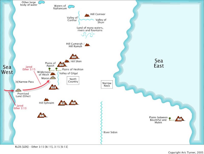
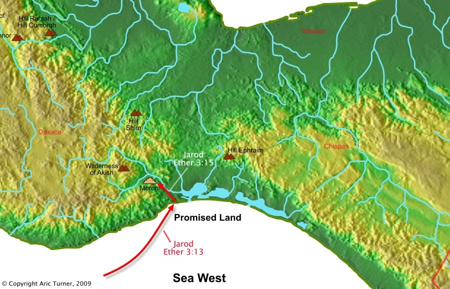
Ether 3:13 And thus they were driven forth, three hundred and forty and four days upon the water; and they did land upon the shore of the promised land.
Ether 3:15 And it came to pass that they went forth upon the face of the land, and began to till the earth.
World Location
Commentary
Mar de Tileme and Mar Muerto are the lagoons on the Pacific coast of the Isthmus of Tehuantepec. They have been used as a port since the earliest European explorers and archaeology shows their use as a port earlier as well. These are the furthest south a boat on the North Pacific Gyre (i.e. the currents) can drift before the currents around the isthmus and prevailing winds that come from the Gulf of Mexico across the isthmus push items out to sea. Boats do not drift any further south along the coast and would require active propulsion to navigate further south along the coast. There are a number of small coves and bays along the Pacific side of the coast of Mexico north of these lagoons. Any of these could also be used for landing boats.
The plains around Mar de Tileme and Mar Muerto are good for growing crops. The coast north of the isthmus is more rocky and drier, not really fitting the description for growing crops. Additional descriptions of Moron indicate that it's located in or near the valley of Gilgal.
The location of Moron on the world map agrees with the possible boat drift, good landing site, and valley descriptions in the Book of Mormon.