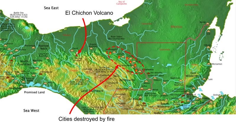
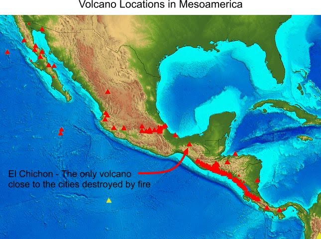
 Here are the volcano locations in Mesoamerica. It can be seen that El Chichon is the only volcano near enough to these city locations to be a possible explanation for the destructions by fire.
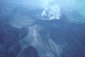
 Here is a close-up of El Chichon before and after its eruption in 1982.
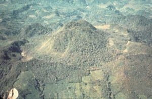
El Chichon Before 1982
(Notice an old caldera around the volcano)
El Chichon After Its 1982 Eruption
But, did it erupt around the appropriate time (around 30 A.D.)?
Past El Chichon Eruptions
480 A.D. +/- 200 years
190 A.D. +/- 150 years
20 B.C. +/- 50 years
700 B.C. +/- 200 years
These dates are based solely on radiocarbon dating. However, carbon from volcanic eruptions does not contain carbon-14, which is what carbon dating uses. Dating eruptions requires dating material growing either before or after the eruption. Volcanic eruptions tend to burn the outside of trees and consumes smaller organic matter, so getting uncontaminated organic matieral from trees tend to be several years (several tree rings into the tree) before the eruption. Here is a statement about radiocarbon dating volcanic eruptions:
In areas of recent volcanism the plants capture volcanic carbon dioxide, devoid of C14 as well as atmospheric CO2. As a result there is a decrease in radiocarbon concentration in recent wood. The apparent radiocarbon age of such recent wood comes sometimes to 6000 years (L. D. Sulerzhitzky, Geological Institute, Academy of Sciences of the USSR, USSR, 1969). Note: This statement says that radiocarbon dates of volcanic eruptions tend to be older than they really are.
Radiocarbon dating makes an assumption that the ratio of carbon-12 to carbon-14 never changes. However, cabon-14 is forming 28% to 37% faster than it's decaying. Melvin A. Cook, `Nonequilibrium Radiocarbon Dating Substantiated', Vol. 2, Pittsburgh, 1986, pp. 59-68. Note: This statement says that radiocarbon dates are older than real dates.
There have also been studies that correlate tree rings dating (exact dating) to radiocarbon dating (estimated dating). A study of tree ring dates to radiocarbon dates shows that around 30 A.D. radiocarbon dates are about 50 years too old.
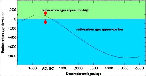 This would make a date of 30 A.D. appear to be 20 B.C. This means the calendar date of the 20 B.C. El Chichon eruption would be 30 A.D. +/- 50 years.
The 1982 eruption was a small eruption. The older eruptions were much bigger. The image above where the 1982 volcano sits inside an older, larger caldera illustrates this fact. The image above does show an even bigger caldera whose diameter is outside the picture. Even though the 1982 eruption was small, the plume shows that it's eruption could cover the cities destroyed by fire.
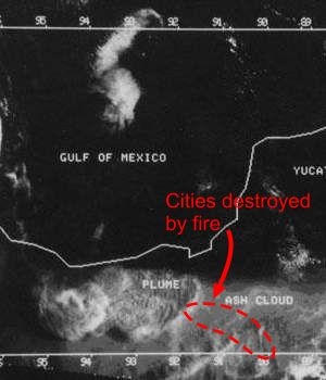 So, the Isthmus of Tehuantepec location of the Book of Mormon Geography can explain the cities destroyed by fire in
III Nephi.
 This would make a date of 30 A.D. appear to be 20 B.C. This means the calendar date of the 20 B.C. El Chichon eruption would be 30 A.D. +/- 50 years.
The 1982 eruption was a small eruption. The older eruptions were much bigger. The image above where the 1982 volcano sits inside an older, larger caldera illustrates this fact. The image above does show an even bigger caldera whose diameter is outside the picture. Even though the 1982 eruption was small, the plume shows that it's eruption could cover the cities destroyed by fire.
 So, the Isthmus of Tehuantepec location of the Book of Mormon Geography can explain the cities destroyed by fire in
III Nephi.
