Helaman 2:3 [3:3]And it came to pass in the forty and sixth, yea, there were much contentions and many dissensions; in the which there were an exceeding great many who departed out of the land of Zarahemla, and went forth unto the land northward, to inherit the land;
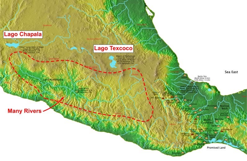
Helaman 2:4 [3:4]: And they did travel to an exceeding great distance, insomuch that they came to large bodies of water, and many rivers;
This verse makes it clear that the large bodies of water are not rivers. Of the several narrow neck world locations, only the locations in Mexico (Isthmus of Tehuantepec) and Egypt have more than one large body of water north of the narrow neck. The lakes in the Egypt narrow neck location are the Dead Sea and Sea of Galilee. Lehi left this area and would have known if he had arrived back in the same location, so this location does not meet the Book of Mormon geography. Does the Isthmus of Tehuantepec location meet the criteria? Yes. Lago Texcoco (surface area up to 7,868 km2) and Lago Chapala (surface area up to 1,050 km2) are very large lakes north of the narrow neck. They exist just outside the boundaries of a watershed that consists of many rivers.Large Bodies of Water (Ithmus of Tehuantepec)

(Tap to Expand)
This is a proof for the Book of Mormon geography since this is the only narrow neck world location that has more than one large body of water north of the narrow neck that is also near many rivers. Joseph Smith could have had access to a map of Mexico with these two large lakes depicted on the map. However, some maps had Lago Texcoco as smaller than Lago Chapala (depicting the drained lake) and other maps incorrectly had Lago Texcoco as its undrained size. Had he used a map showing the drained Lago Texcoco, the waters of Ripliancum (Lago Texcoco as confirmed by the intersecting valleys proof) would not have had a size that exceeded all others.
