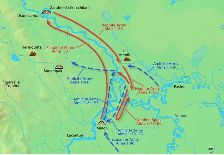
ALMA 1:65 [2:12] Therefore the people of the Nephites were aware of the intent of the Amlicites, and therefore they did prepare to meet them;
ALMA 1:70 [2:15] And it came to pass that the Amlicites came upon the hill of Amnihu, which was east of the river Sidon, which ran by the land of Zarahemla, and there they began to make war with the Nephites.
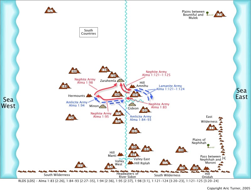
The Nephite army pushed back the Amlicite army. The Amlicite army retreated to the city of Minon and joined a Lamanite army and the Nephite army stopped at the valley of Gideon.
ALMA 1:76 [2:20] And it came to pass that when Alma could pursue the Amlicites no longer, he caused that his people should pitch their tents, in the valley of Gideon, the valley being called after that Gideon who was slain by the hand of Nehor with the sword; and in this valley the Nephites did pitch their tents for the night.
The valley of Gideon is on the east of the river Sidon.ALMA 4:8 [6:7] And went over upon the east of the river Sidon, into the valley of Gideon, there having been a city built which was called the city of Gideon, which was in the valley that was called Gideon, being called after the man who was slain by the hand of Nehor with the sword.
A battle ensued and the Amlicites and Lamanites were driven to the northwest into the Hermounts (a wilderness, hilly area). The details can be read on Alma Travel Map 1 and Alma Travel Map 2.
ALMA 1:93 [2:35] And it came to pass that when they had all crossed the river Sidon that the Lamanites and the Amlicites began to flee before them, notwithstanding they were so numerous that they could not be numbered;
ALMA 1:94 [2:36] And they fled before the Nephites, towards the wilderness which was west and north, away beyond the borders of the land;
ALMA 1:95 [2:36-37] And the Nephites did pursue them with their might, and did slay them; yea, they were met on every hand, and slain, and driven, until they were scattered on the west, and on the north, until they had reached the wilderness, which was called Hermounts;
The key geography points are:
- Hill on the east side of the river Sidon north of a valley which enters the river Sidon also from the east.
- Hilly or mountainous area to the northwest of the river Sidon between the valley of Gideon and Zarahemla.
Alma Travel Map 1

Alma Travel Map 2

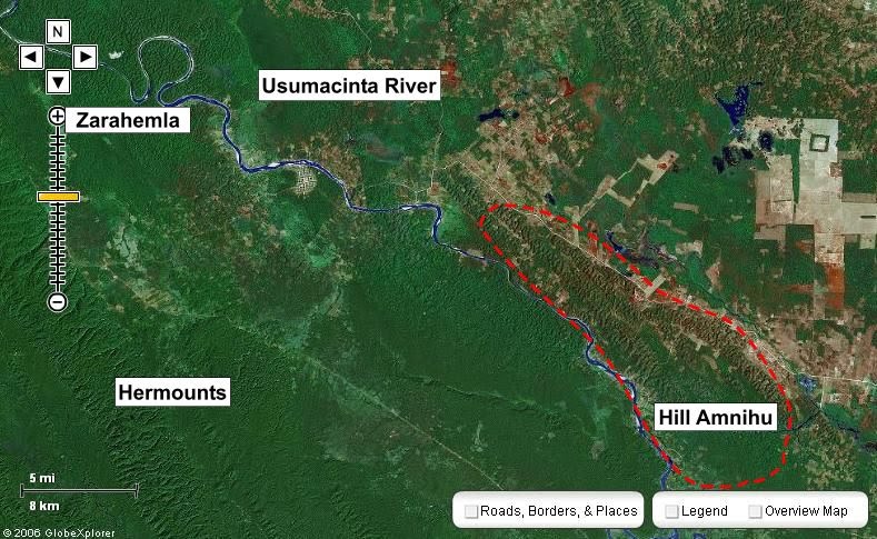
The Usumacinta river has a 400-foot tall hill on the east side of the river north of where the Rio Pasion enters the Usumacinta river.
400-Foot Tall Hill (Mesoamerica)

The small river in the picture above goes around the hill. Here is a closer look at the hill.
Hill Amnihu Close-Up (Mesoamerica)

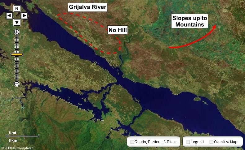
This Usumacinta location is the only narrow neck location that has these geographic features. Some early maps put mountain artwork on the east side of the Usumacinta river, but not in this location north of the Rio Pasion. This hill did not appear on maps until after 1934 and it could be argued that not even until detailed topographic data was gathered in the 1980's and 1990's. The Grijalva river has slopes up to mountains on the east side of the river so there are no hills on the east side of the river north of the one river that enters it from the east.
Grijalva River (Mesoamerica)

