Cities Destroyed by Water (Mesoamerica)
(Tap to Expand)
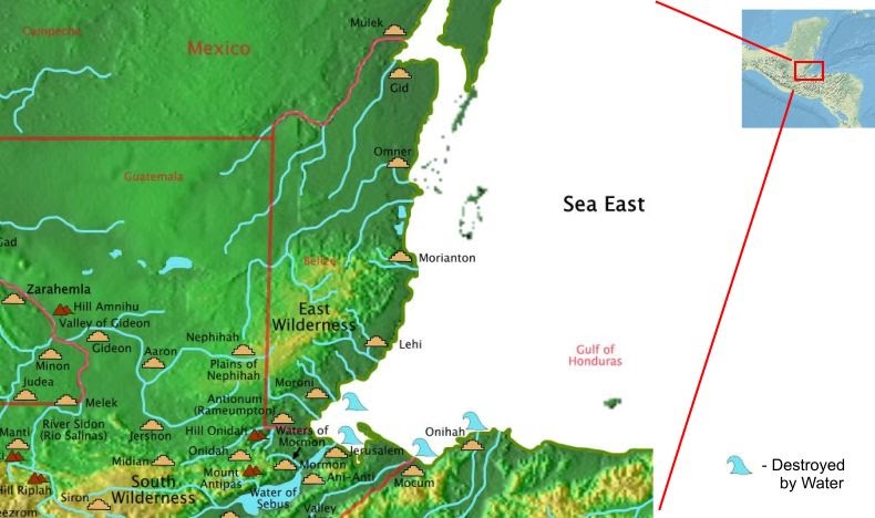
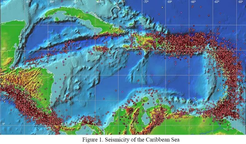
The destruction of the cities of Onihah, Mocum, and Jerusalem is described as the waters coming up. This describes either a storm surge or a tsunami. Storm surges along the coast have been recorded at over 17 feet during hurricanes. The troubling aspect of this is that winds were not described as being one of the forces that were part of the destruction. Considering that King Limhi talked about an east wind of destruction in Mosiah 5:50 and Abinadi mentioned the same destructive east wind in Mosiah 7:53, if winds were part of the destruction, there is precedence for mentioning it. Storm surge cannot be discounted, but information is not available to confirm it. Tsunamis do not require any associated wind. So, can they describe the destructions defined? A study was created in 2003 called the "Estimation Of Far-field Tsunami Potential For The Caribbean Coast Based On Numerical Simulation" by Narcisse Zaibo, Efim Pelinovsky, Andrey Kurkin, and Andrey Kozelkov published in Science of Tsunami Hazards, Volume 21, Number 4, page 202 (2003). This source was located on the internet in 2006 (note that the internal model that placed Onihah, Mocum, Jerusalem, and Moroni on the sea east coast was developed in 2004). The authors investigated the source of earthquakes, the shape of the sea floor in the Carribean, and developed a model for predicting where tsunamis would occur.
Earthquakes around the Carribean
(Tap to Expand)
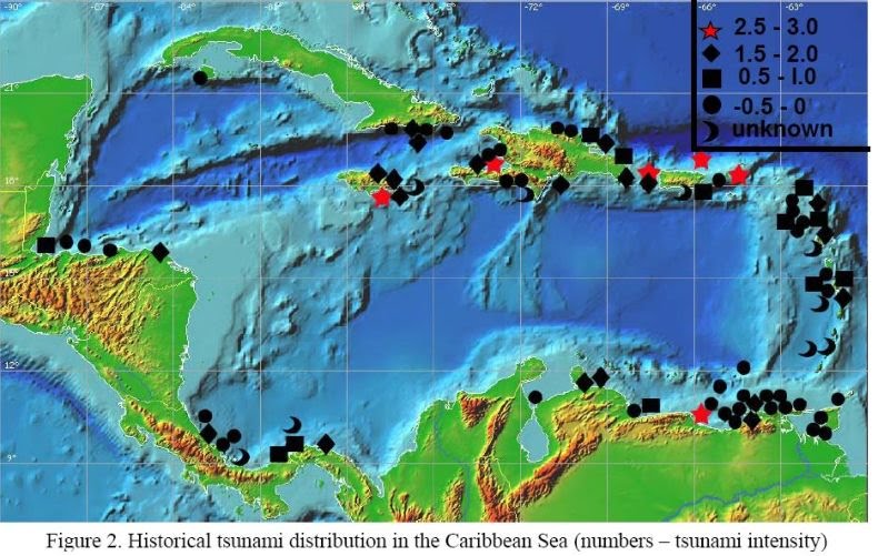
They looked at historical tsunamis (heights are in meters).
Historical Tsunamis around the Carribean
(Tap to Expand)
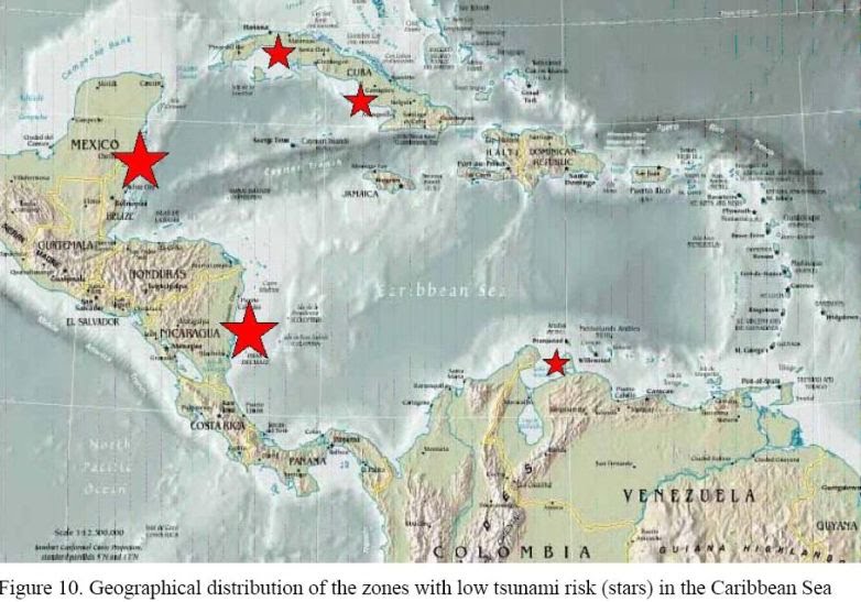
And they determined where tsunamis would NOT occur.
Safe Coasts for Tsunamis around the Carribean
(Tap to Expand)
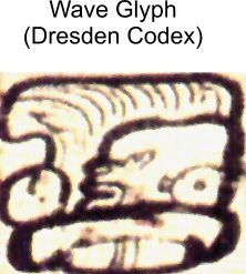
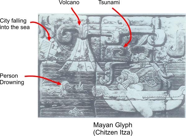
The areas safe from tsunamis and where historical tsunamis have occurred match exactly the cities that were and the cities that were not destroyed by water described in the Book of Mormon. The Isthmus of Tehuantepec is the only narrow neck location where tsunamis can confirm the destruction by water described in III Nephi. To answer the question about whether or not the people in Mesoamerica knew about tsunamis, here are two Mayan glyphs that show tsunamis.
Maya Wave Glyph
(Tap to Expand)
Maya Destructions Glyph
(Tap to Expand)
