Book of Mormon Geography represented by water and terrain

Book of Mormon

Geography

Proofs & Discoveries


Early Mesoamerican Maps

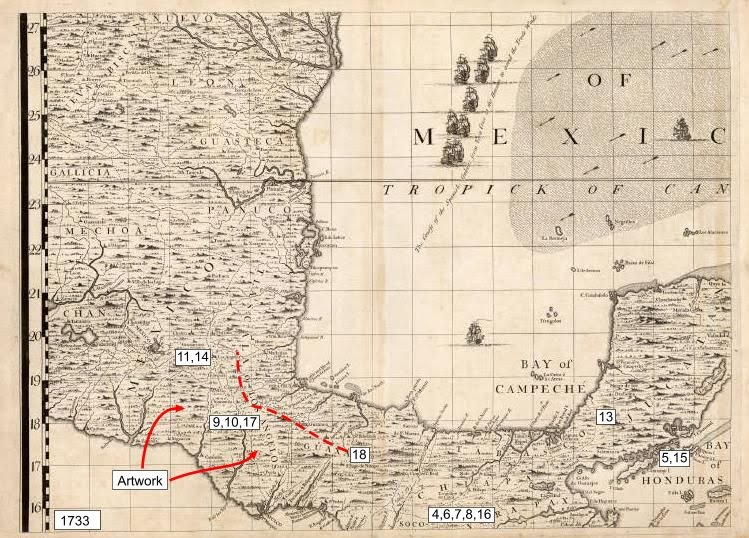
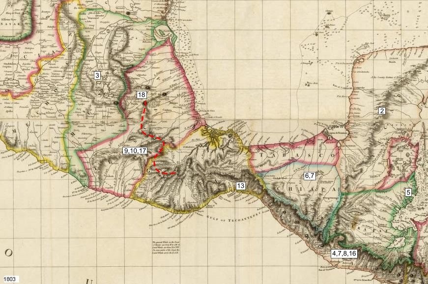
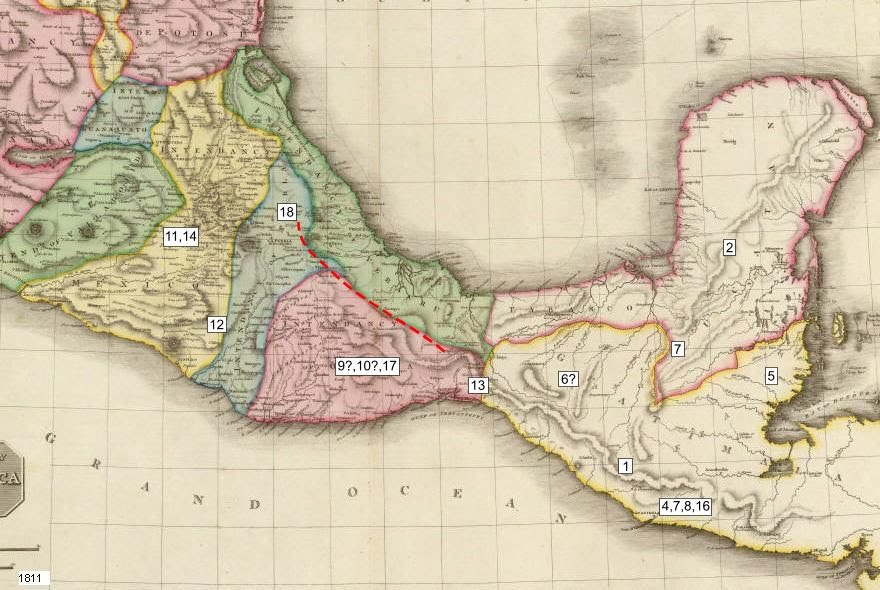
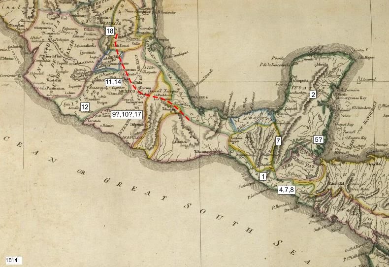
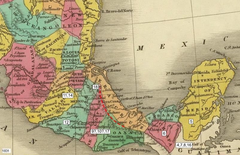
Without going into too many details, there are 18 points of inaccuracies that I want to highlight about maps of Mesoamerica that were published before the Book of Mormon. These points are discussed in the proofs, travel maps, and commentaries. The dates of the maps are displayed in the lower left-hand part of the map. While these maps are not all of the maps published before 1830, they are representative of the maps published in that time frame. The same inaccuracies are found on other maps of that period. Not only is the Book of Mormon geography more accurate than these maps, none of the inaccuracies on these maps show up in any geography described in the Book of Mormon.

Another aspect of maps of Mesoamerica made in this time frame are that they were not immediately available in the United States. Many were first made available to Spain and it took time, sometimes years, for them to become available to the United States.
  1. People traveling could not miss the river Sidon (Mosiah 5:60-64)
  2. Fictitious mountain range
  3. Shows Lake Texcoco (when it didn't exist)
  4. No east/west valleys of the river Sidon
  5. No East Wilderness
  6. No Hermounts
  7. No Hill Amnihu
  8. No hill north of Shilom
  9. No Hill Ramah / Hill Cumorah
  1. No Hill Shim
  2. No multiple "large bodies of water" 
  3. No "many rivers"
  4. No plains
  5. No Ripliancum (Lake Texcoco)
  6. No river systems (Hondo or New rivers)
  7. No narrow South Wilderness
  8. No valley of Shurr or Corihor
  9. Rivers were too short (incorrect Santo Domingo river)